
NORTH WEST ARGENTINA SAMPLE ITINERARIES
SOUTHERN LOOP FROM SALTA
Salta > Cafayate > Estancia Colome > Cachi > Salta
This circuit travels south from Salta and showcases some of the country's most spectacular landscapes; the journey is slow, dusty and remote yet incredibly beautiful. Expect dramatic red-rock canyons, high-altitude vineyards, striking deserts, tranquil valleys, and colonial villages all encompassed by huge skies. It's a journey of ever-changing landscapes, rich Andean culture, exceptional wines, and some of Argentina's most breathtaking scenery.
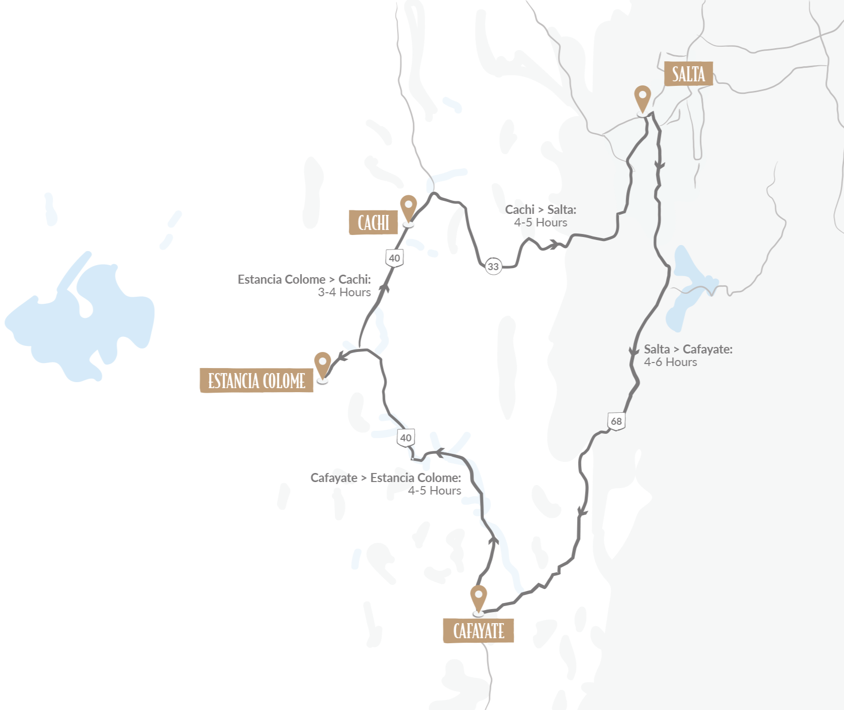
Suggested 5 night Itinerary
Day 1: Salta → Cafayate
Highlights: Quebrada de las Conchas, dramatic red-rock formations, Garganta del Diablo, viewpoints along Ruta 68a
Day 2: Cafayate → Colomé
Highlights: Cafayate / Calchaquí Valley, high-altitude winery visits/tastings, Cafayate town
Day 3: Cafayate → Colomé
Highlights: Scenic Ruta 40, spectacular mountain scenery, historic Molinos and its adobe/colonial architecture
Day 4: Colomé
Highlights: High-altitude wine country, remote and peaceful atmosphere, James Turrell Museum, beautiful colonial/hacienda-style accommodation, hiking / horse riding
Day 5: Molinos → Cachi
Highlights: Seclantás, traditional weaving villages, Ruta 40 scenery, Quebrada de las Flechas, Cachi
Day 6: Cachi → Salta
Highlights: Los Cardones National Park, Piedra del Molino, Cuesta del Obispo
A note on Altitude
Salta - 1,152 m (3,780 ft)
Cafayate - 1,683 m (5,522 ft)
Estancia Colome - 1,683 m (5,522 ft)
Cachi - 2,531 m (8,304 ft)
Day 1: Salta → Cafayate
Driving: 4 hrs direct / 6 hrs with scenic stops.
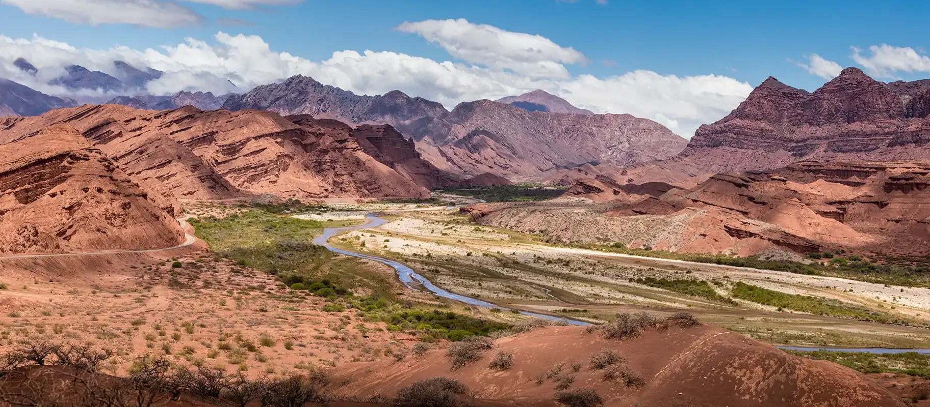
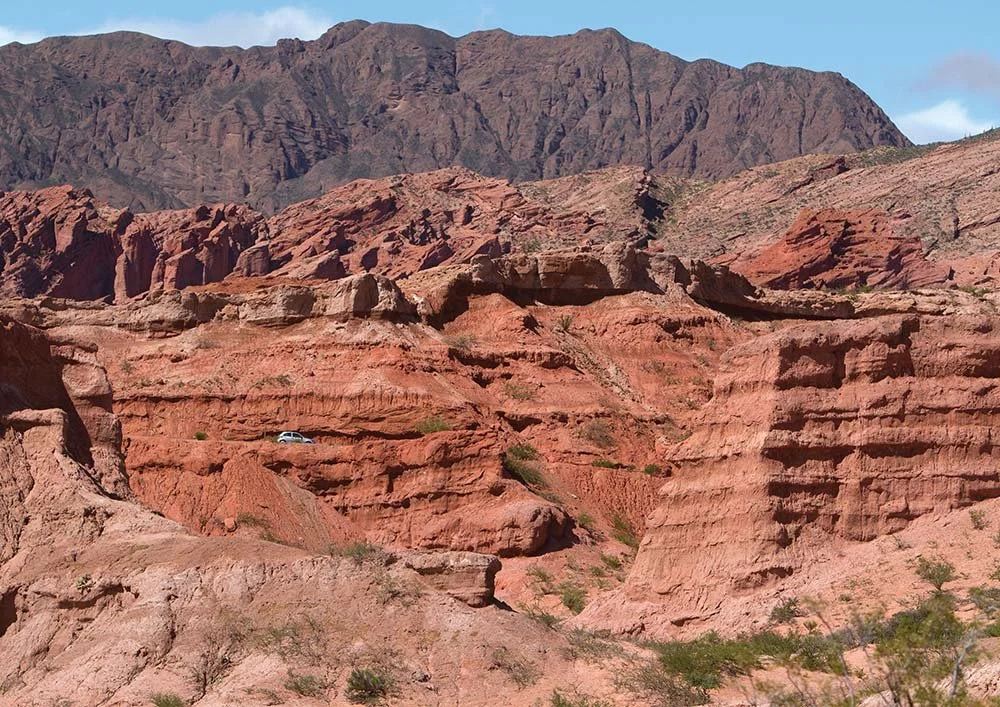
Route 68, the main paved road connecting Salta and Cafayate, is one of the most scenic drives in Argentina. Leaving Salta the scenery becomes greener as you pass through agricultural valleys and vineyards. It begins to dry out as you approach the Quebrada de las Conchas - the most spectacular part of the drive which feels almost otherworldly thanks to its dramatic desert canyon landscape. Famous for its vivid red rock formations, layered cliffs, and erosion-shaped valleys, the Quebrada de las Conchas (Canyon of the Shells) got its name from all the fossilized shells which can be found here. The beauty of having your own car to explore this region means you can make numerous stops to enjoy panoramic views over the valley of the Río de las Conchas and admire the surrounding mountains and their richly coloured bizarre rock formations.
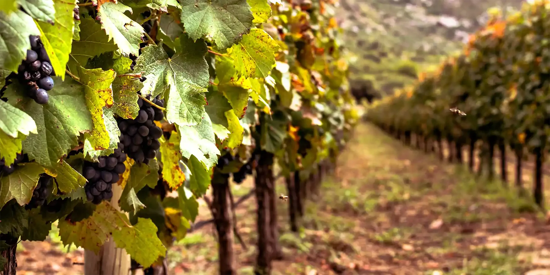
Approaching Cafayate, the transition into wine country feels surprisingly gentle after the intensity of the canyon. The landscape gives way to wider plains framed by distant mountains. and becomes softer and more cultivated: vineyards begin appearing against the desert backdrop, fed by meltwater from the Andes.
Day 2: Cafayate
Spend the day exploring the vineyards surrounding Cafayate.
Cafayate is a small high-altitude wine town which feels both remote and lively. Characterised by its low rise colonial white washed buildings and shaded plazas, its cobbled streets are lined with outdoor restaurants, wine bars, artisan stalls and bodegas.
Unlike Mendoza’s larger wine regions, Cafayate feels intimate and rural. Vineyards begin almost at the edge of town, and many wineries are small enough to visit casually in an afternoon.
In the evenings people gather around the plaza to enjoy traditional folk music and peñas. Synonymous with high-altitude viticulture Cafayate is best known for its Torrontés wine — Argentina’s signature aromatic white grape.
The surrounding landscape gives the town much of its character, as it sits in a semi-desert environment at around 1,700 m the colours here are so vivid: rust-red cliffs, pale sand, verdant green vines, and deep blue sky.
Day 3: Cafayate → Colome
Driving: Much of it is gravel or rough mountain road, and so it usually takes 4 to 5 hours without major stops.
Leaving town along the Ruta Nacional 40 the landscape again changes quickly, and the road becomes quieter and feels more remote. Vineyards disappear and the terrain opens into broad, dry valleys covered with giant cacti and isolated adobe homes. The roadside is punctuated by the odd wandering donkey or goat and tiny roadside chapels - what is immediately noticeable is the remoteness of this part of the country and the unhurried pace of life.
Along the way you will pass through small villages with dusty plazas where life is slow and traditional. A particular favourite is Molinos which is especially atmospheric and the perfect spot for lunch.
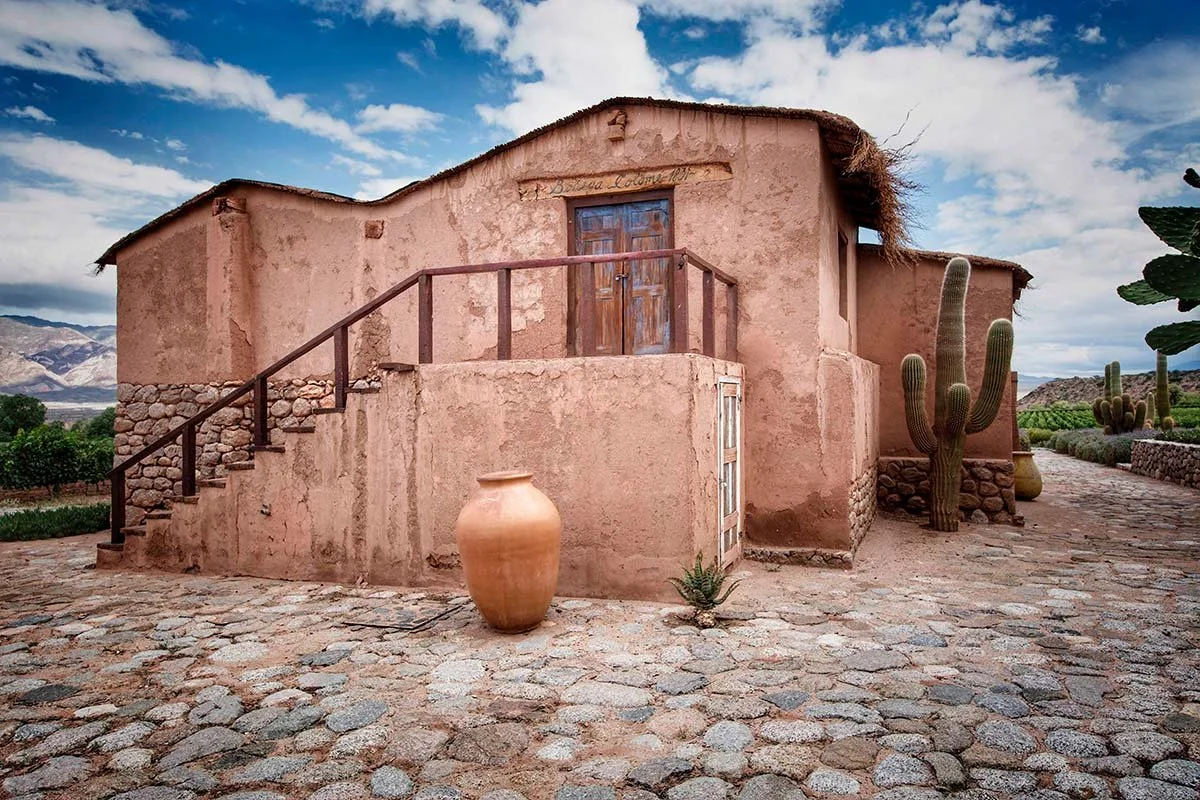
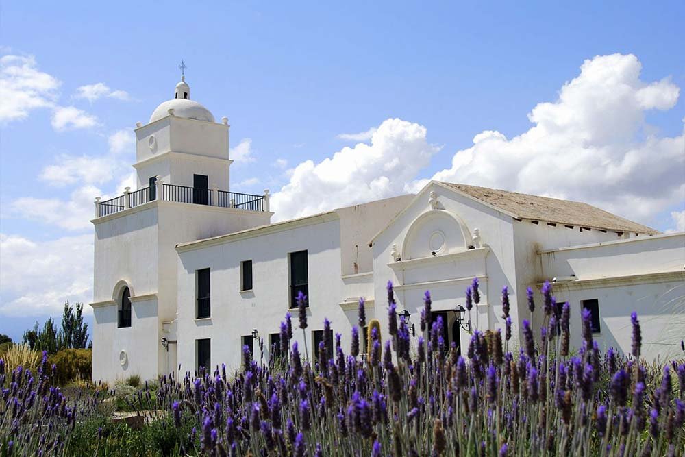
Stay at Estancia Colome, a remote boutique property boasting one of the world’s highest-altitude wineries. Colome’s intimate, quiet and secluded setting is mecca for those seeking to relax underneath big skies, enjoy premium altitude driven wines and explore the surrounding valleys.
Day 4: Colomé
Spend the day exploring Colome’s high altitude vineyards.
Estancia Colome boasts the oldest winery in the country. Spend the day exploring its high altitude vineyards, and sampling the bodega's unique wines.
There is a swimming pool and tennis court at the estancia for those looking to relax. Hiking and horse riding are a beautiful way to explore its surroundings and an unexpected highlight is the James Turrell Museum. This a unique place dedicated to the light-and-space artist James Turrell, featuring immersive installations designed around light perception and the desert sky.
Day 5: Colomé → Cachi
Driving: 3-4 hours depending on road conditions and stops.
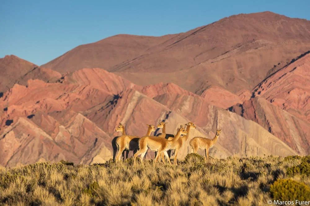
Leaving the quiet isolation of Colomé and descending back toward Molinos, you will gradually rejoin Ruta 40. The road winds through the heart of the Calchaquí Valleys, following broad desert valleys framed by layered mountains in shades of ochre, rose, grey, and deep red.
Long empty stretches of road disappear into huge Andean landscapes and then pass by small villages and roadside stalls selling ponchos, empanadas and sweets. Expect lots of dust, occasional river crossings and very little mobile signal!
Seclantás is a tiny traditional Andean village, known for its adobe houses, traditional crafts and weaving, and its historic architecture. Classified as a Lugar Histórico Nacional, it’s particularly associated with the area's handwoven textiles and ponchos.
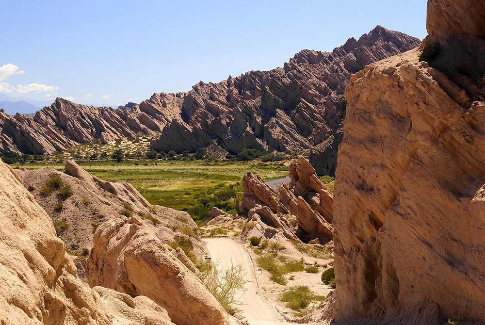
The Quebrada de las Flechas is a 20 km corridor of extraordinarily eroded rock formations, where enormous layers of sandstone have been tilted almost vertically. The result is a landscape of razor-like rock walls and spires that look as though giant stone "arrows" are sticking out of the mountains.
-
As you approach Cachi, the valley gradually becomes greener and more cultivated. Snow-dusted peaks sometimes appear in the distance, and the town itself emerges almost unexpectedly — a small colonial settlement with cobbled streets, adobe buildings, and a peaceful central plaza. In comparison to Cafayate, Cachi feels quite different in atmosphere, landscape, and rhythm. It is quieter, higher and more traditional. Its whitewashed buildings, small church, and low sun-baked walls give it an almost preserved appearance.
Day 6: Cachi → Salta
Driving: 3.5 to 4.5 hours without extended stops - many travellers like to leave a full day to absorb the remarkable changes in scenery during the journey - from high-altitude desert to subtropical forest and finally to the green valleys surrounding Salta.
Leaving Cachi along Ruta Nacional 33, the road climbs steadily through the Los Cardones National Park, a vast protected area with forests of towering giant cardón cacti. The landscape is open and expansive, with rolling hills, golden grasses, and panoramic views of the surrounding peaks.
The highest point of the journey, Piedra del Molino (3,348 m) affords sweeping views across the mountains and, on clear days, a striking sense of the region's scale. It's not unusual to see condors soaring overhead.
From here the route begins a spectacular descent along the Cuesta del Obispo ("Bishop's Slope"), a historic mountain road known for its dramatic switchbacks and jaw dropping scenery as the arid highlands gradually give way to greener vegetation.
Lower down, the landscape transforms into lush cloud forest within the Yungas and eventually, the road reaches the fertile Lerma Valley, where vineyards, farms, and small villages signal your approach to Salta.